.jpg)
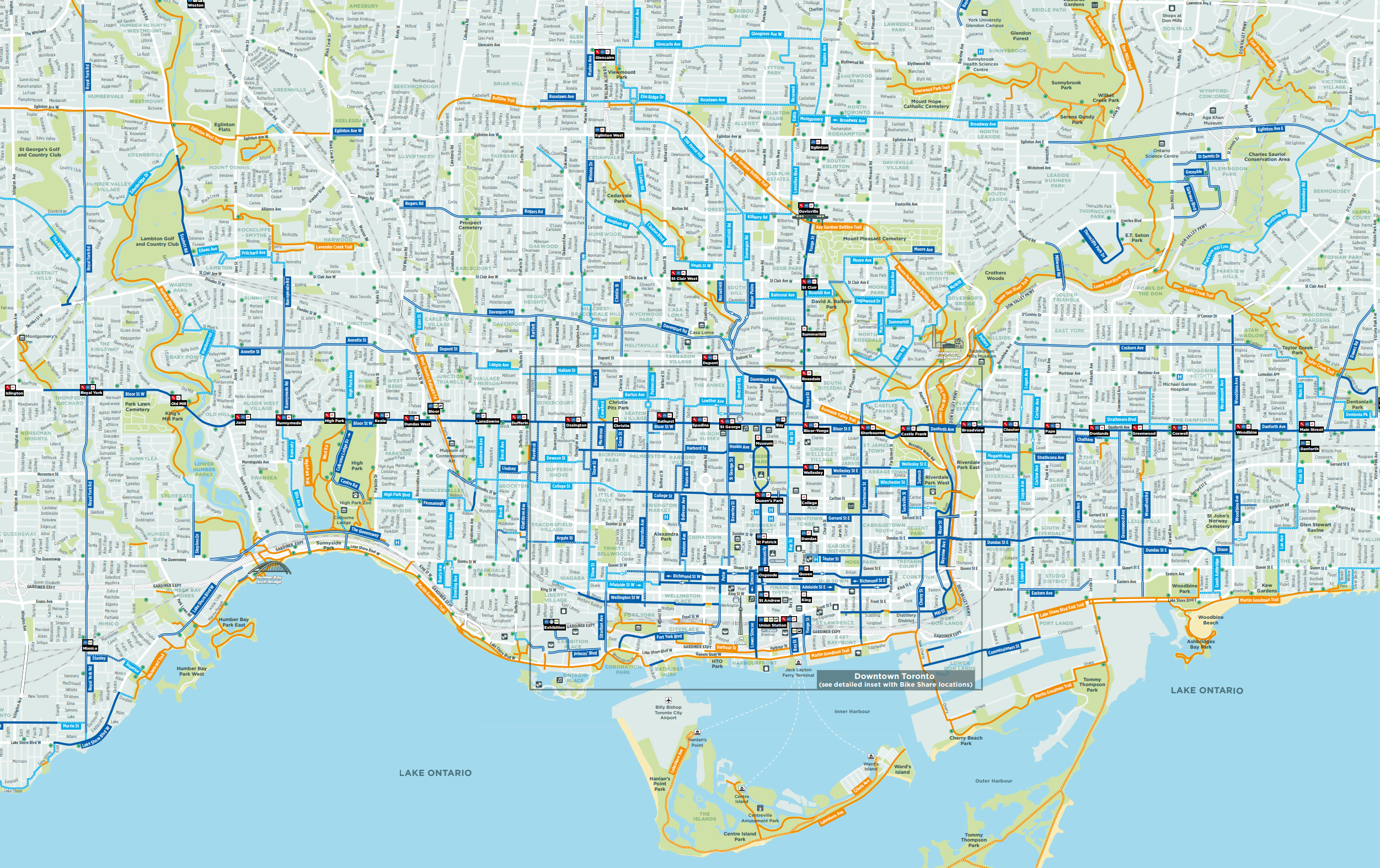
Happy Trails is a subway map style breakdown of Toronto's multi-use trails. It's not meant to replace a conventional map of the trails, but is meant to make it more apparent where the trails go, where they stop and why. If we understand why the trail network looks the way it does, we can better understand opportunities for growth and improvement.
Happy Trails isn't about Toronto's bike lanes. The bike lanes are great, should be considered just a standard piece of city infrastructure and while there is lots to say about Mr. Ford's ignorant approach towards cycling in the GTA, this site isn't about that.
The trails are good fun. They're also very popular, at least when the weather is pleasant and they provide an important respite from the noise and chaos of the city. Getting out on the trails is a great way to get some exercise but it's also in some places the fastest way to get around on a bike and could be a good way to help alleviate some of Toronto's notorious congestion.
Unfortunately, the trail network isn't quite ready for prime time. Development, highways, railways, and golf courses all slice up what should be connected network. Golf courses are particularly bad: they're land hungry (there are over 2000 acres of golf courses in the GTA) and are typically located in the ravines, replacing natural riparian zones with lawns and restricting public access to the most important natural areas the city has to offer.
Toronto, as far as I can tell, isn't known to be a great place for cyclists. It's better known for horrific traffic jams and a "War on Bikes", which it seems is being waged in order to make the traffic jams worse for some reason. Meanwhile, brand new billion dollar transit projects are slower than jogging. Doug Ford's Ontario defies all logic. That said, the Greater Toronto Area (GTA), despite decades of questionable leadership, is fortunate enough to have about 400km of multi use trails and 240 km or so of bike lanes. Yes, Mr. Doug Ford wants to turn back the clock to the bad old days and yes, our cycling infrastructure lags behind (depending how you add it up) Vancouver, Montreal, Ottawa and even frozen, car-loving Edmonton and Calgary, but all the same, our geography is favourable, the weather isn't as bad as you think, and cycling here gets better all the time.
On street bike lanes may be on hold, but the multi-use trail network continues to grow. The multi-use trails, which is what this website is all about, are the (mostly paved) trails that are (mostly) seperated from the city's traffic-choked streets and meant for walkers, joggers, scooters, wheelchairs, bikes, e-bikes and teenagers escaping their parents-- in other words, anything but cars, trucks, taxis and all the things that are actively trying to kill you when you bike to the grocery store.
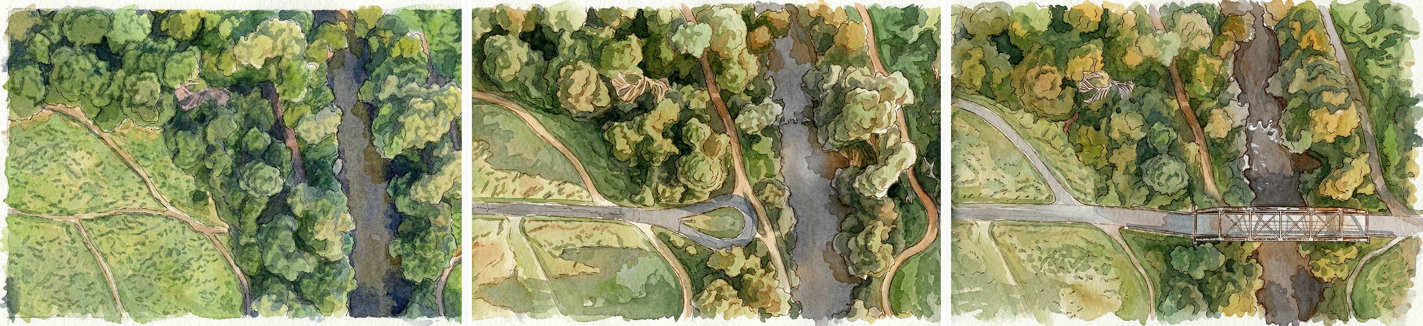
The trails mostly exist (with some notable exceptions) where development wasn't possible for various reasons such as flooding in Toronto's many ravines or the fact that people don't want to live under the high voltage wires in Hydro corridors. There is also the Beltline Trail, which has a wild history and follows the route of a long-defunct railway, and there's the Waterfront Trail, which has had some impressive upgrades in the last decade. Toronto city planners over the decades did their very best to make the city unlivable (why not build a raised highway on the waterfront or put one our major rivers in a trench?) yet there were places that even they could not despoil, and this is where you will find the trails. The trails mostly lie in the many ravines and lucky for us Toronto is a city of ravines. On a sunny day when the weather is warm, they are glorious.

Happy Trails isn't meant to replace Google Maps. It does, however, address some of the shortcomings that these maps have. First of all, Google Maps is a real jumble. A map of the entire planet is a real accomplishment, but cycling is clearly not the focus. There's just too much noise, trails are missing, or mislabelled, or are marked in a way that is simply incorrect.
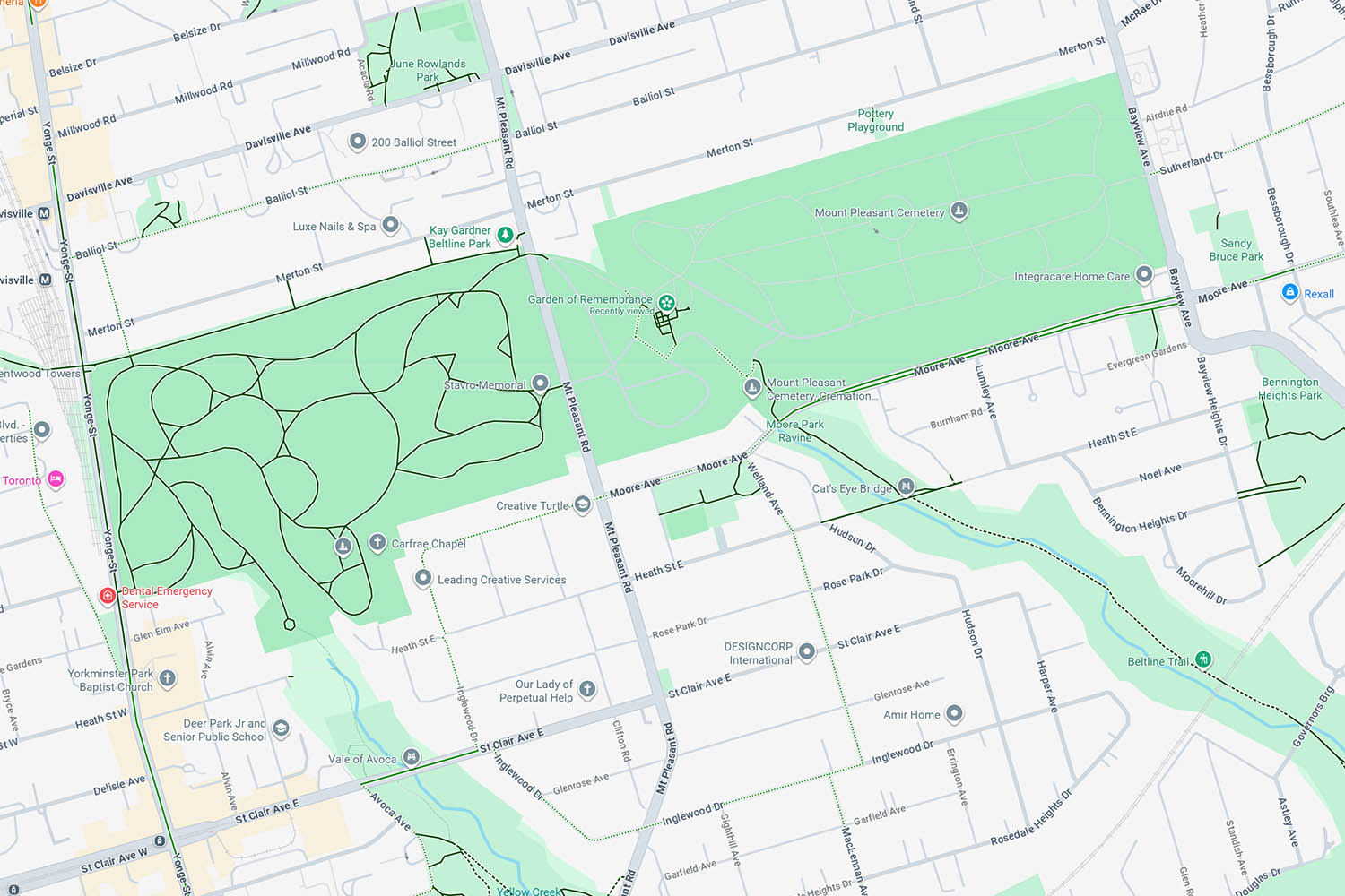
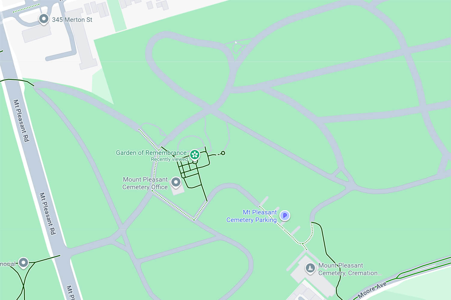
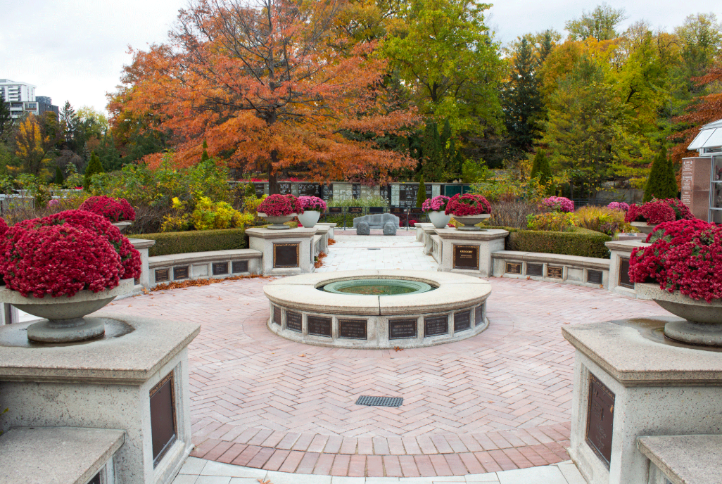
Mount Pleasant Cemetery is a good example: The West half of the cemetery is marked like it's a cyclist's paradise, while the Beltline route through the cemetery, which most of the cycling traffic going through the cemetery will use, is missing. The 'Garden of Remembrance' looks like a cluster of bike trails-- it certainly is not. These types of problems are all over Google Maps-- it's simply not very reliable or useful for cycling. Believe it or not I've tried to upload some "user feedback" to Google Maps in regards to the way bike lanes are marked, but without any success. In any case, the errors are too widespread.
The Toronto Cycling Map is better. I have a copy at home. The trails are clearly marked in orange and much of the irritating clutter is gone. It could be improved by marking the trails as either "primary" or "secondary" and by removing some more of the noise, but it gets the job done. As far as I can tell tho, it's meant to be a paper map, and is just a big PDF. There's no interactivity and it's cumbersome to look at online (seems to load very slowly, at least for me). Montreal has a similar map, but does it much better. It also doesn't say anything about why the trails go where they do. Why, for example, does the Taylor Creek trail have an irritating gap between Pharmacy and Victoria Park Ave? Users of Happy Trails will know the answer.


Happy Trails is half map, half infographic. Yes, it will tell you where the trails go, but if you want to understand the trail network better, or why the network is so fragmented, Happy Trails is for you. The goal here is to present a lot of information in a way that is simple and accessible and to be useful to people with a range of knowledge and experience on the trails. These maps also draw from a range of sources and aim to provide current and accurate info about the trails as they are and will be in the future. A major goal of the map is to show how different parts of the city impact each other and how, in a some cases, the barriers to the trails were or could be overcome.
This project is also about looking forward. Happy Trails seeks to illustrate the existing trails and the barriers to expansion, while also proposing opportunities for improvement. The site offers a clear picture of the challenges faced by trail builders, such as golf courses, highways, and railways. By using the "Wishful Thinking" button users can toggle proposed solutions to the various barriers to a better connected trail network. Some of these ideas are mine, some are from planning documents or elsewhere.
The challenge going forward is to overcome the historical encroachment in the remaining natural areas, and turn the fragmented mess of trails into a coherent network that is greater than the sum of its parts. Some areas will be more difficult than others, such as the lower part of the Humber River, which is encroached upon by residential development dating back to the 1800s. In other places the solution is easier. It's not unreasonable to expect that golf courses provide space for the trails to bypass in the ravines. 11 of the 18 golf courses in the city are owned by the city, at the very least these should be compelled to allow trail bypass. This would be a simple solution to connecting many trail fragments.
Cycling is becoming more popular than ever before, and there are several major trail projects currently underway in the GTA. For example, the East Don River project will create kilometers of new trails and link up with another ambitious trail (and rehabilitation) project called the Meadoway, which will eventually extend as far as Rouge Park. While closing tricky gaps and building necessary bridges and tunnels will be challenging, progress is being made, and the city is slowly moving in the right direction on this front.
.jpg)
Some of the "Wishful Thinking" entries may seem a little far fetched. Why build a bridge over the Allan, for example, when users of the Beltline trail can get across on a road bridge? The answer is simple. We want to live in a city that prioritizes walkers and cyclists and a healthy active lifestyle. Toronto is not some impoverished backwater, it is a place that can do more for it's residents. It's about a vision for a city that celebrates and encourages access to natural spaces and dreams big.
I urge users of this site to think a little bigger, and to ask for a little more. Why impoverish your own imagination? If we can afford the many concrete vehicle bridges over the Allan we can afford a much smaller and cheaper pedestrian bridge. If we can afford to spend billions on highways we can afford the comparatively humble infrastructure that the trails require.
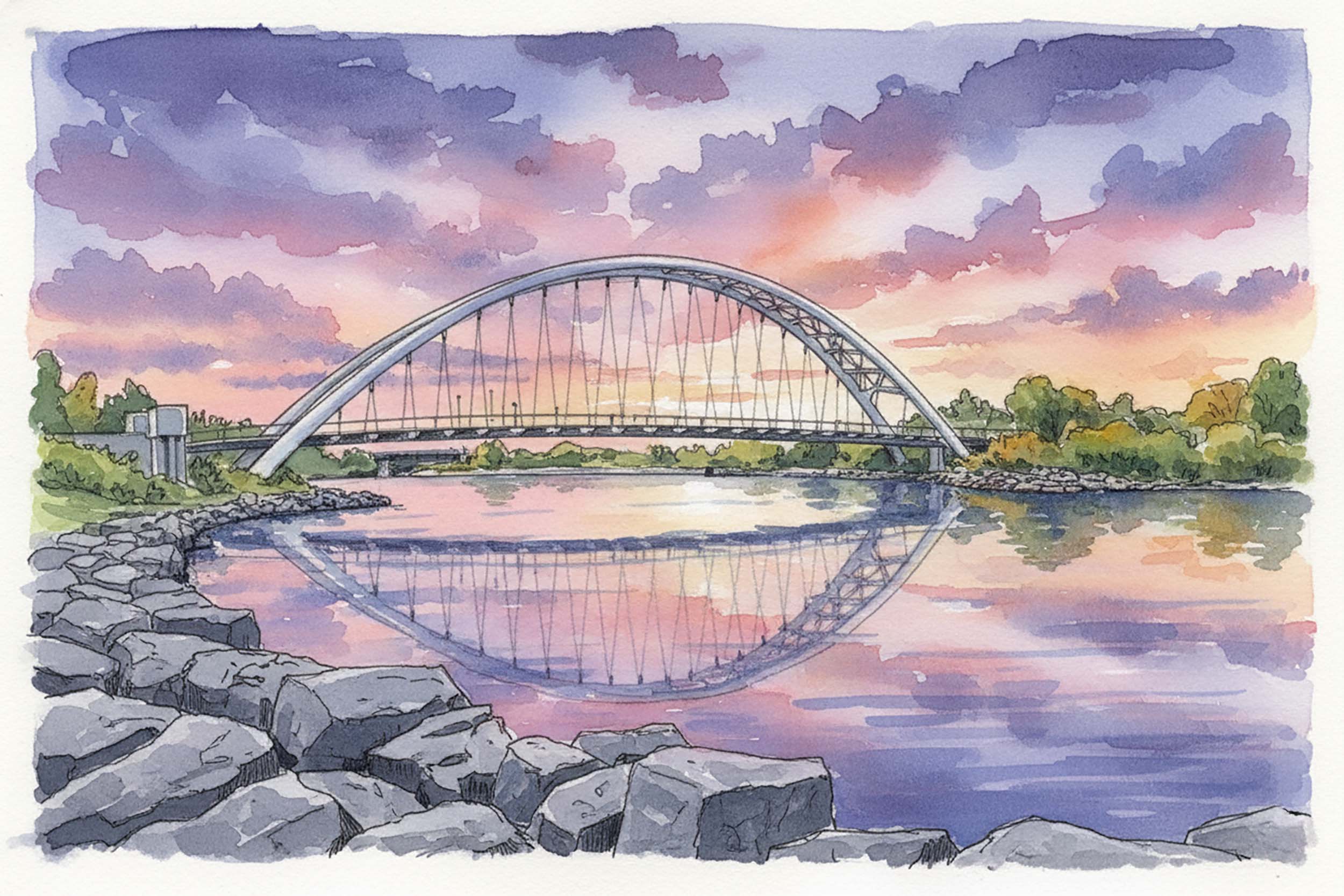
if there's a symbol for what this site is hoping to push for, it's the Humber Bay Arch Bridge. Built in 1994, there's nothing else quite like it in the city. It's an "enduring landmark" and represents the kind of bold thinking that this city needs. It's also a popular spot, often full of tourists enjoying the view and trail users on bike and on foot enjoying the trip down the waterfront. Well, it's been 30 years and now is the time to start thinking about the next Humber Bay Arch Bridge, and the one after that! Imagine a project of this scope every few years, or even every decade! Perhaps Happy Trails will help to encourage users of this site to dream a little bigger.
One crucial part of the puzzle is obviously getting the word out. When my wife and I moved to Toronto we were told by long-time residents, even people our own age, to stay out of the lake. It was just too polluted. Well, times change, and attitudes need to change with them. Just as the lake is now great for swimming, Toronto is slowly becoming a city that has some excellent cycling infrastructure. I haven't done a survey, but I suspect, and my personal experience tells me that public awareness of the trails lags behind. I'm an avid cyclist, but it took me longer than it should have to discover and become familair with the trail network. Happy Trails attempts to be a small piece of this, getting the word out, hopefully inspiring people to get out on the trails.
It's worth taking a moment to imagine what the multi-use trail network would have looked like if it wasn't such an afterthought, squeezed into natural areas that were mostly left unpaved because they were unsuitable for development or were freed up when a railway went bankrupt for example. Imagine if the paths were part of city planning from the early days. Bikes have, after all, been around as long or longer than cars and have always been popular. It's safe to assume that the value of being in nature is not a new phenomenon. What would this city look like if we had a more complete trail network, perhaps one with routes set aside before development took it's couse? Can you imagine a city with a network of trails offering an efficient and extensive and beautiful way to get around by bike? Image another 10 Beltline trails crisscrossing the city.
Well, it's too late to realize that now, and hard to image a city like Toronto having that kind of vision, but it's not too late to improve and expand and connect the existing trails.
If you head out onto the trails in 2026 you'll probably notice that the trails often seem cobbled together. It's not surprising. The trails start life as informal walking trails that have formed over decades, possibly many decades. As the city grows up around the trails the walking paths become more popular and the natural area becomes degraded by a muddy branching mess of dirt walking paths. Eventually it gets to a point that the local municipality decides to put a little work in and replace the many trails with one paved or "surfaced" trail, at the same time possibly taking measures to discourage people from using the dirt paths.
At this stage the new hard surface trail, while it is certainly an improvement, was probably only built with the needs of the local community in mind. There isn't much thought to how the trail could connect to other trails. There's no thought to standardizing the trails in different parts of the city either- some will be narrow, or have excessively steep bits or poorly planned gates or other idosyncracies. The signage will be poor or lacking entirely. Where the trail encounters an obstacle, it will come to a screeching halt. The first obstacles will be water- and the first real trail infrastructure built will be bridges.
As the trail becomes more popular and grows it will encounter more difficult obstacles: highways, railways, greedy golf courses and irresponsible urban encroachment on natural areas. And that's where we are now. The easy part is done, now it's time to connect the network, at which point the trails become greater than the sum of their parts. As cycling becomes ever more popular (and bikes get better as well) trail users can go further and the demands on the trails will only grow. With e-bikes that range increases again as does the age range of the people you'll see out on the trails. Now is the time to push a little harder, to do a little better, to make these trails really something special. Let's not be afraid of change. Let's not be afraid to fix the mistakes of the past, even if that process is difficult. It's worth it.
While this project is a hobby, I'm passionate about cycling and believe in the value of well-planned and interconnected trail networks. With continued support and advocacy, Toronto can become a world-class cycling city with a network of trails that are beautiful, accessible, and extensive. I put this together just for kicks, from a love of cycling in the trail system, driven in part by frustration with the existing maps and the problems with the trails as they are now. Toronto is a city that seems always on the verge of greatness... here is another chance to really get it right.
.jpg)