


.svg)
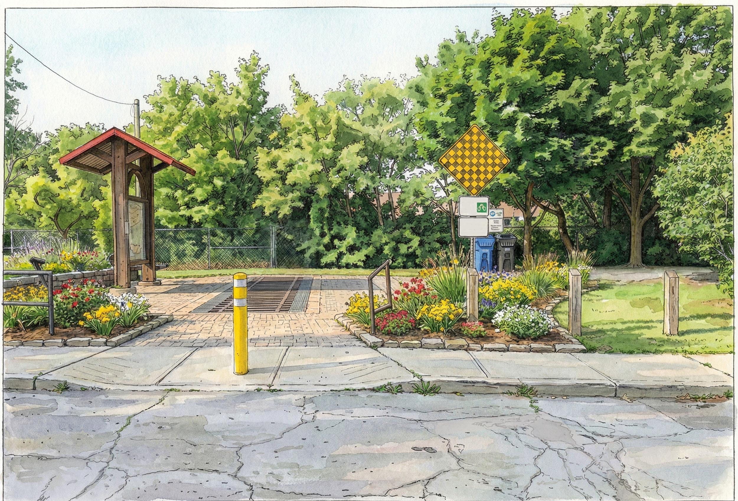
The sad truth is that the part of the trail West of Allan Rd. is a bit shabby and less popular than the more treed and scenic portion to the East. The trail starts where the former Belt Line Railway joined the main trunk line. When this portion opened it 1988 it must have been an attractive sight, now, though, its fallen somewhat into disrepair. A little landscaping would do wonders, the signage needs to be replaced, and at the very least the curb cut really needs to be moved to where the trail actually starts. Presumably it was put off to one side to prevent cars from driving onto the trail but a bollard would do the same thing without routing bikes across the grass. The rusty old gates, which seem to be permanently open, could be removed easily enough.
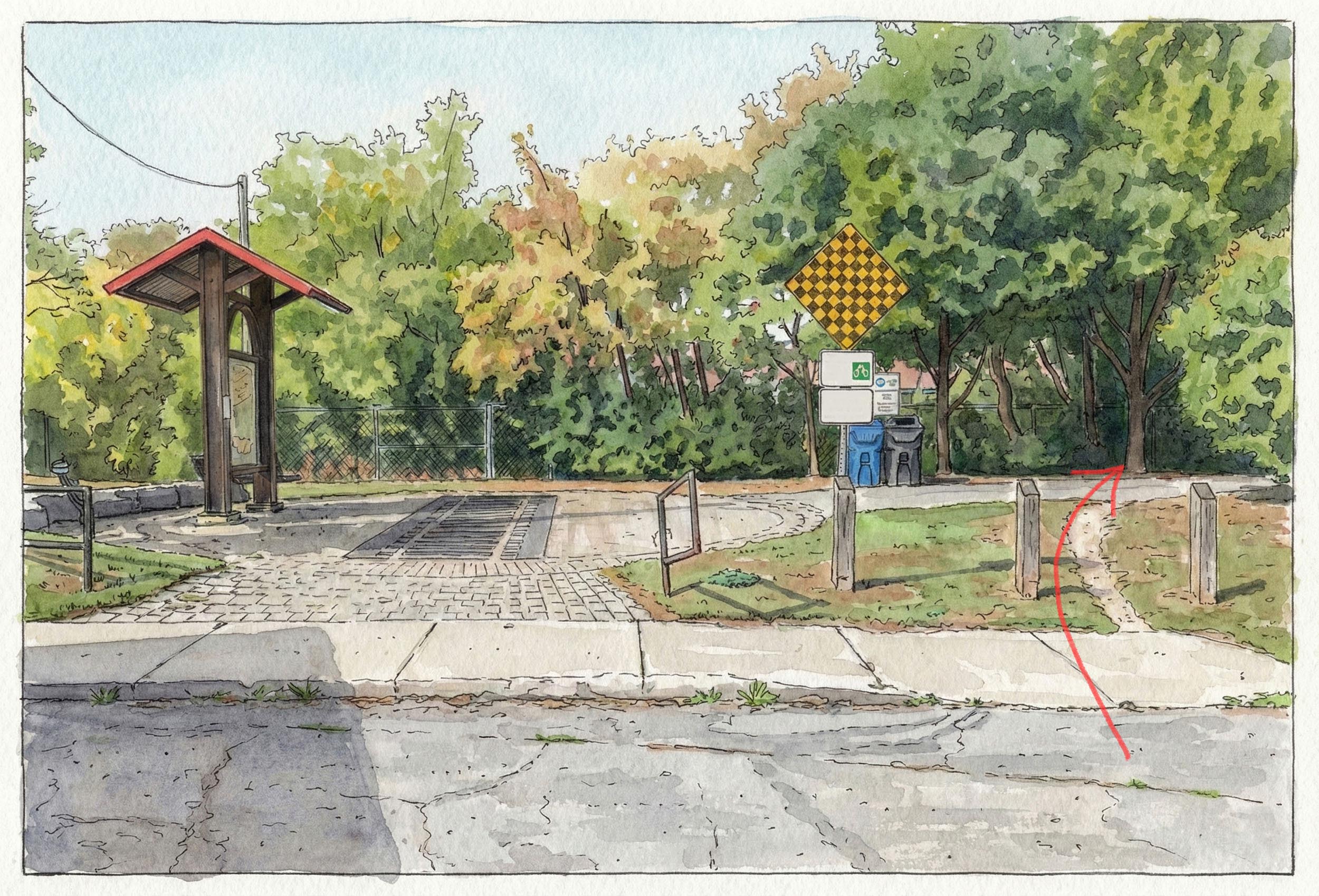

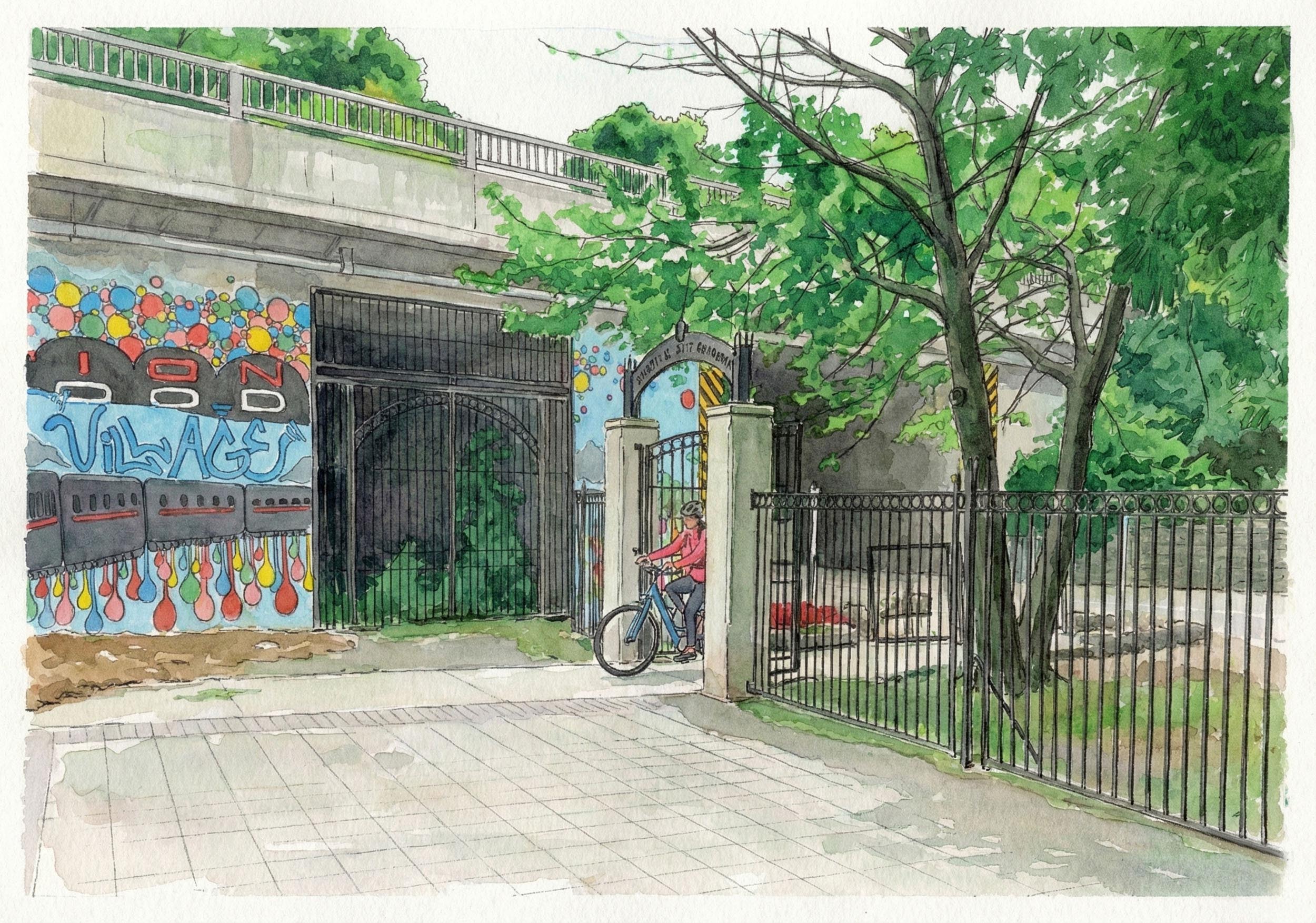
The Beltline trail begins where the Toronto Belt Line railway used to connect with the main trunk line. A railway pattern in the concrete reminds trail users of the history, as well as an info board under a covered roof. This part of town is industrial and commercial but the strip of greenery is just enough to give a little taste of nature.
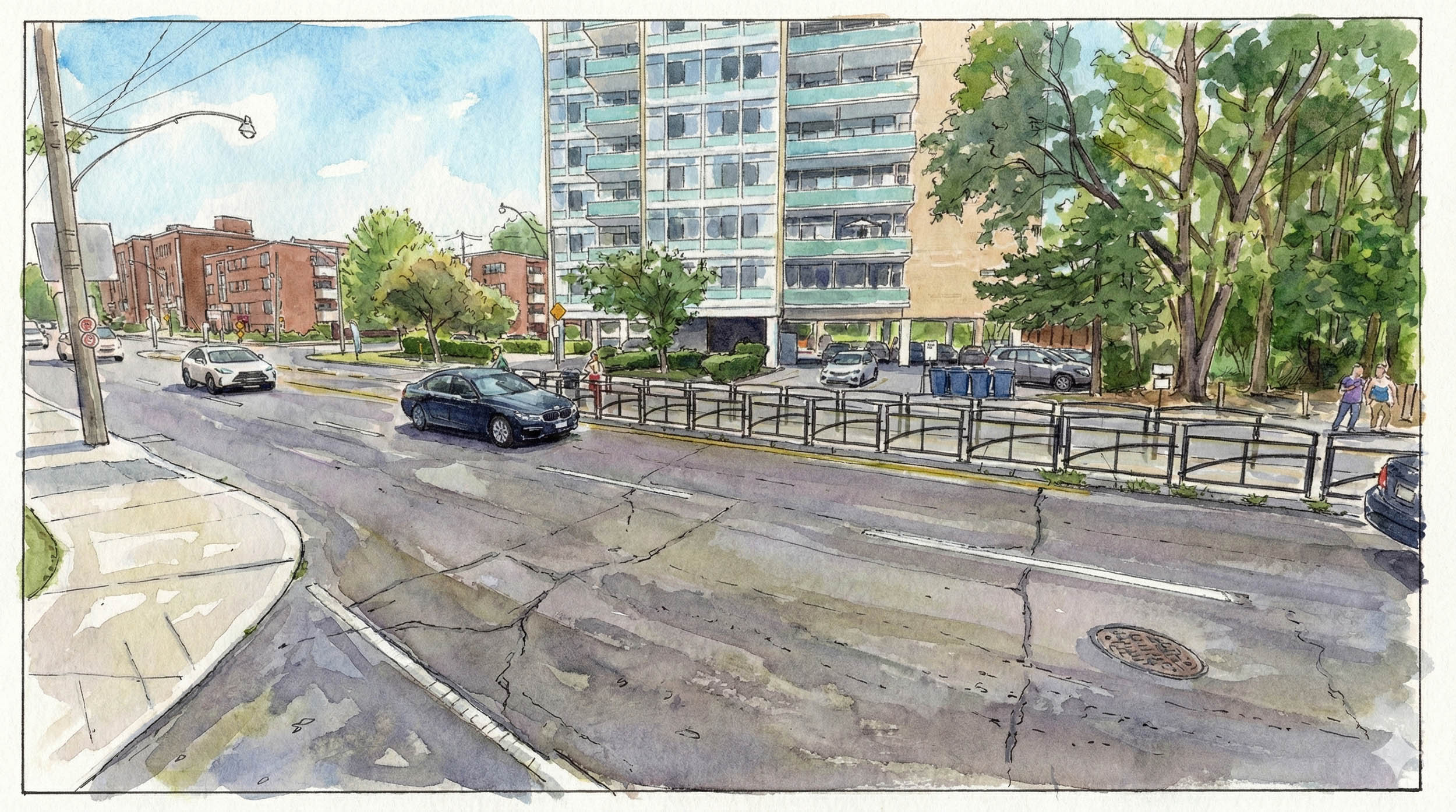
It doesn't really make much sense to me that a popular trail like the Beltline is missing crosswalks in a few spots, such as where it crosses Ronald Ave. A humble crosswalk doesn't seem like a lot to ask for, especially on a trail that has been around since 1988. Progress is being made slowly tho- Caledonia Rd. was also missing a crosswalk until recently. There are plans to add a "pedestrian island" here, which I think is a rather poor option.
It doesn't seem like much but this kind of infrastructure on a multi-use trail is still pretty rare in the GTA. Many bridges span the Don and Humber rivers but road crossings are almost always at grade, with or without a crosswalk or stoplight. What a pleasure to glide over the traffic below without having to stop and wait! These bridges were of course built for the railway that formerly followed this route.
While we're lucky to be able to use this space now, it's worth taking a moment to imagine a city in which the paths weren't an afterthought, fought over and eventually squeezed into a place that was left undeveloped for reasons that have nothing to do with the enjoyment of the public and getting around in a way that's fossil fuel free. What kind of city would we have if these spaces had been planned for and set aside as the city grew? It's not so far fetched; bikes have been around as long or longer than cars after all, and presumably people have always enjoyed a stroll in nature. Sadly cars continue to utterly dominate our cities.
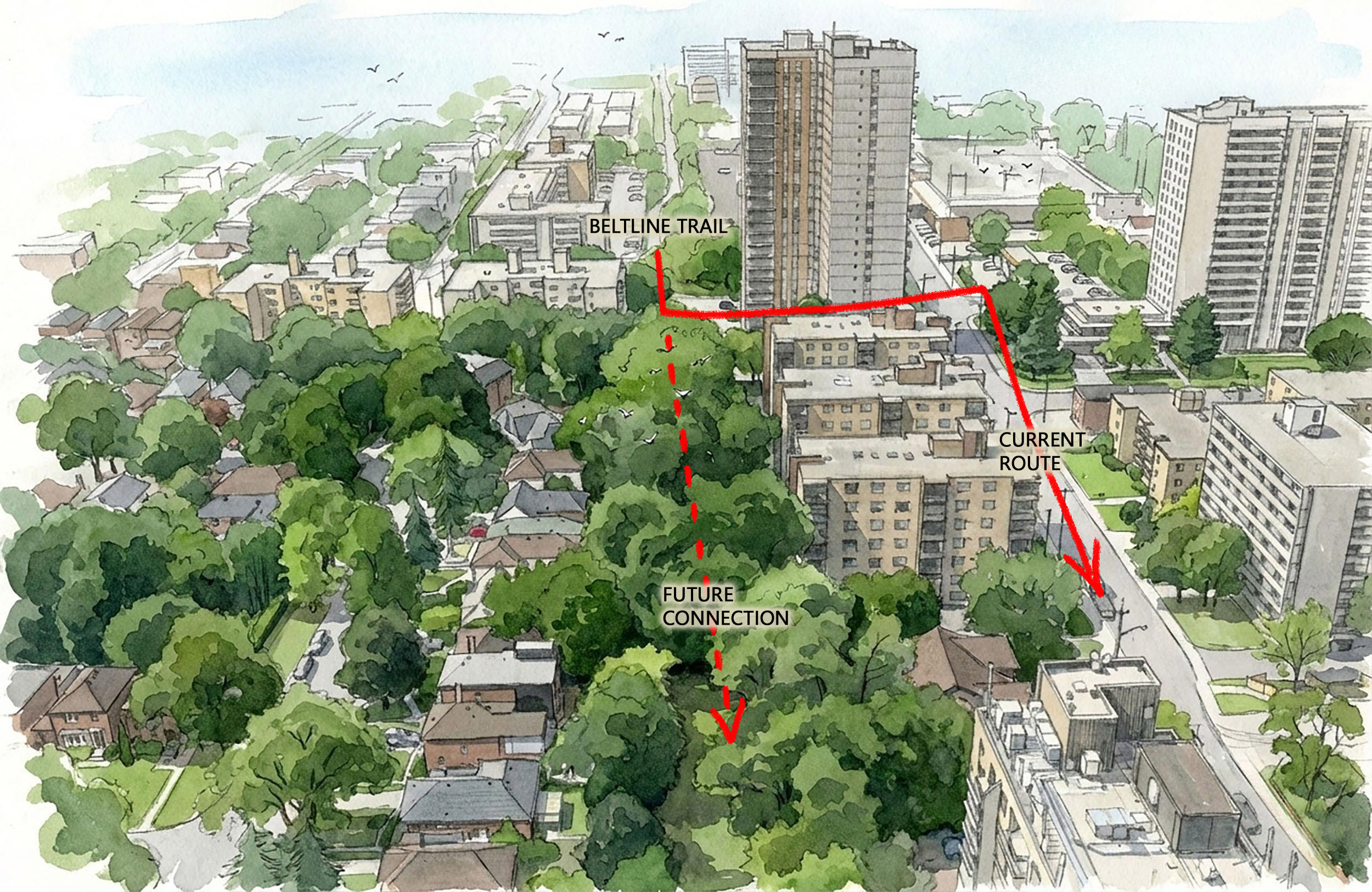
There are plans to extend the Beltline trail up to Allan Rd. The work was supposed to have been completed by now. The latest notice says construction in 2027.
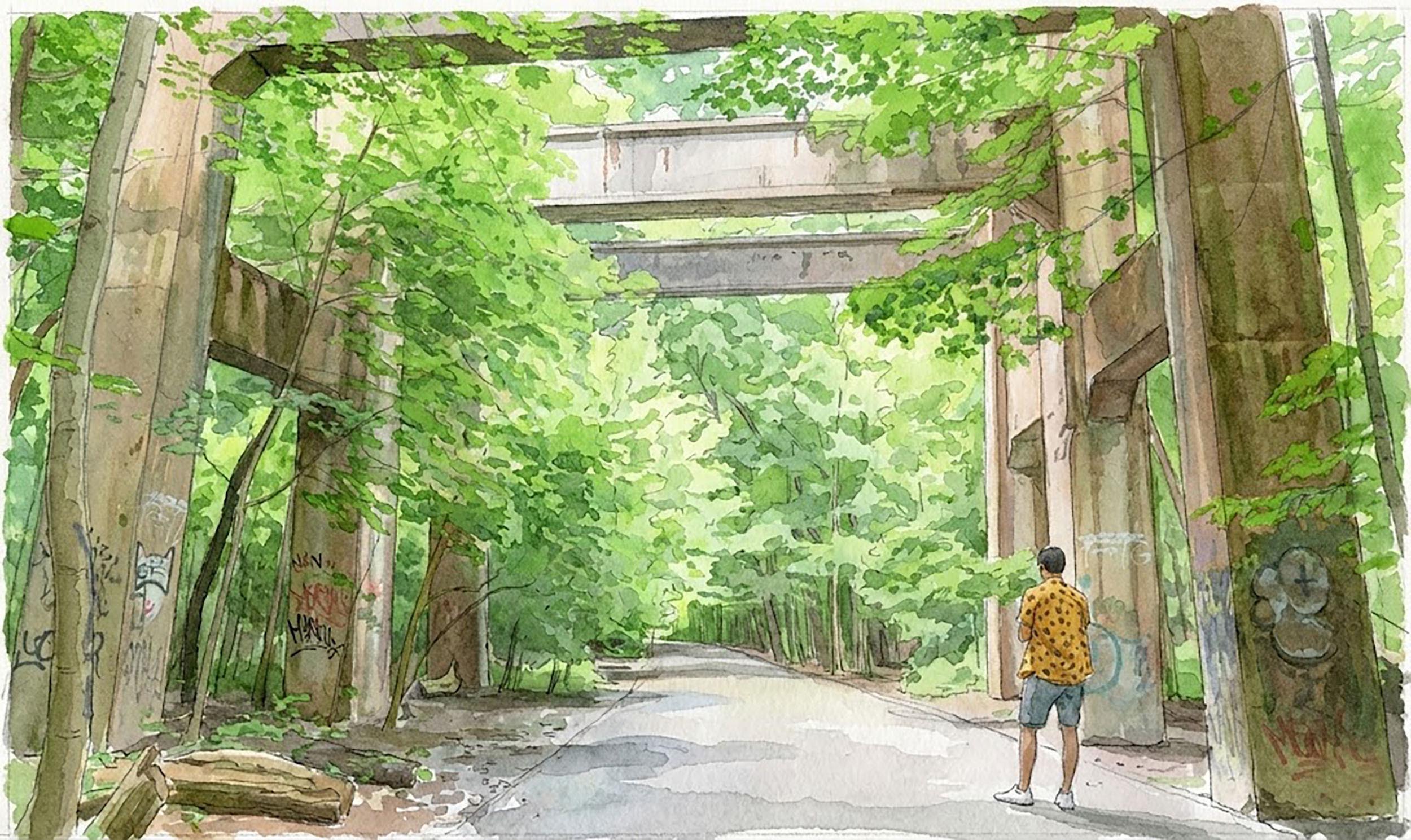
The story of Allan Rd. is really the story of Toronto in some ways. A massive trench blasted through Midtown, wiping out hundreds of houses, with the intention of pushing a freeway into the heart of the downtown, eventually forced by public outcry to stop in the early 70s. It was an abitious and deeply misguided project. The bad news is that these car centered mega-projects still litter the landscape, while an ambitious new vision for the city is lacking or faces pushback. Where other cities have begun the long and expensive process of reckoning with this history, Toronto has moved slowly. This is unfortunately still a very divided and conservative town.
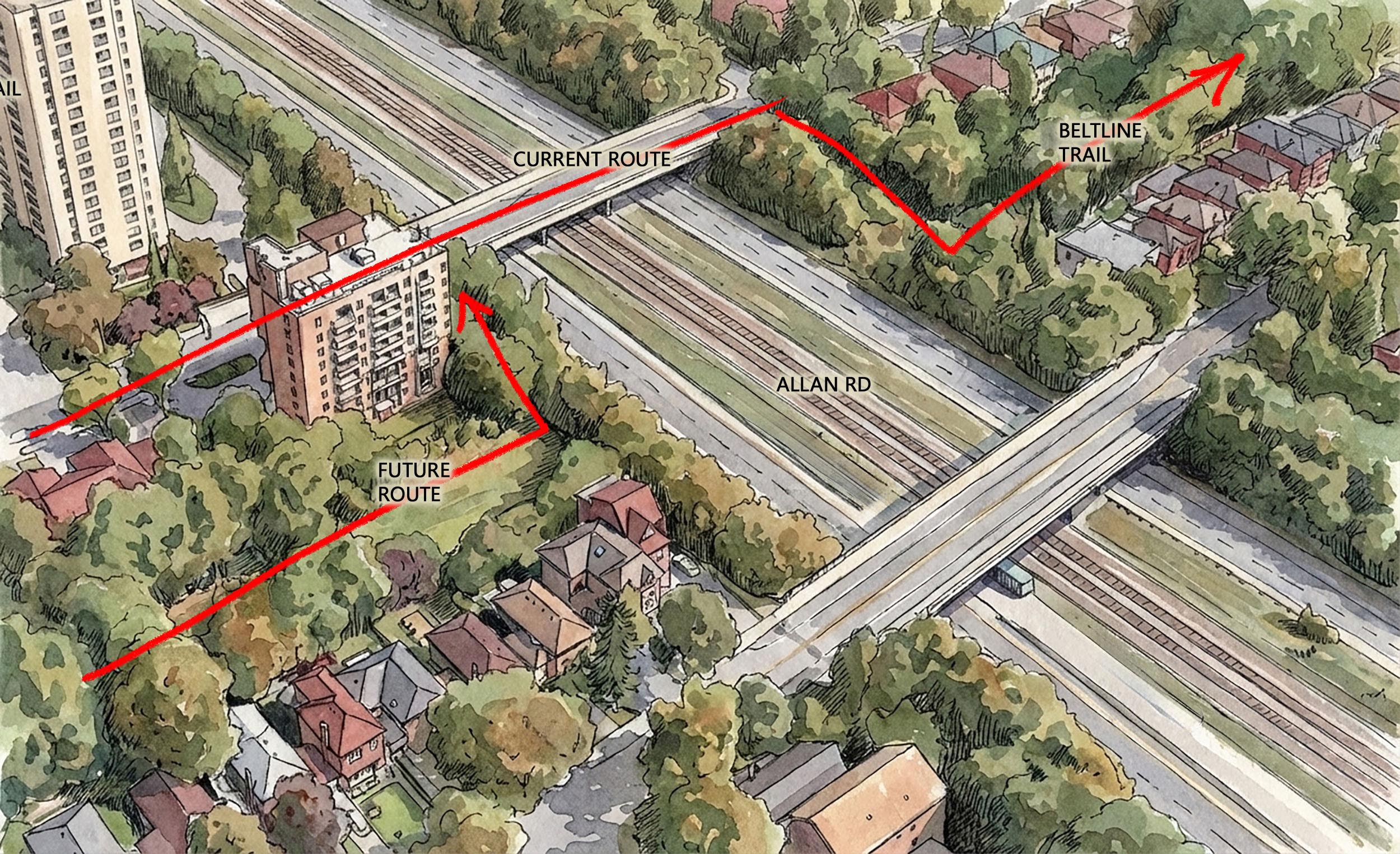
The Belt Line Railway was demolished where Allan Rd. bisected it, and the Beltline trail that replaced the tracks is divided to this day, 50 years later. Currently the trail stops on the West side of Allan at Marlee (though there are plans to extend the trail at some point- currently "on pause") and trail users are forced to bypass up Marlee on the sidewalk to Roselawn/ Elm, which crosses Allan Rd. There is no bike lane and this can be a busy part of town.
I propose a pedestrian bridge. Yes it would be expensive. This is the time, however, for a little ambition, for an investment into the things that make the city inspiring and enjoyable. If the city could afford to build 9 concrete bridges over Allan Rd, it can afford one pedestrian bridge. It wouldn't be the longest in the city either, or the first to cross a major highway.
Allan Rd bisected the rail line in 1972, and the Beltline trail continues to be bisected here 50 years later. A bypass on Marlee and Roselawn/ Elm Ridge is required. There is no bike lane, merely "sharrows", which personally I'm convinced are only there to give drivers the pleasure of driving over a picture of a bicycle. At the far end is a big wall running parallel to the highway.
True, this one isn't a big deal. The crosswalk is inconveniently placed. But the beauty of the trails, apart from a little dose of nature and an opportunity for a little outdoor exercise, is the opportunity to get away from Toronto's terrible traffic. So if there's on thing the trails need to get right is seperating the traffic from the non-traffic. Also, on the East side of this intersection, the curb cut routs any wheeled traffic (bikes, strollers, rollerblades etc) off to one side and between the pole and guy wire, which isn't great. In places like this the trail seems like an afterthought.
We have to assume there is a reason that a simple crosswalk isn't used in this space, but inviting kids, people pushing strollers, old people etc to run out into traffic is just a terrible idea. I've seen lots of drivers blow through crosswalks but at least the rules are clear. Here cars are NOT expected to stop for pedestrians. It's like a game of frogger. I really wish that whoever makes these decisions would simply rule out "pedestrian islands" as an option.
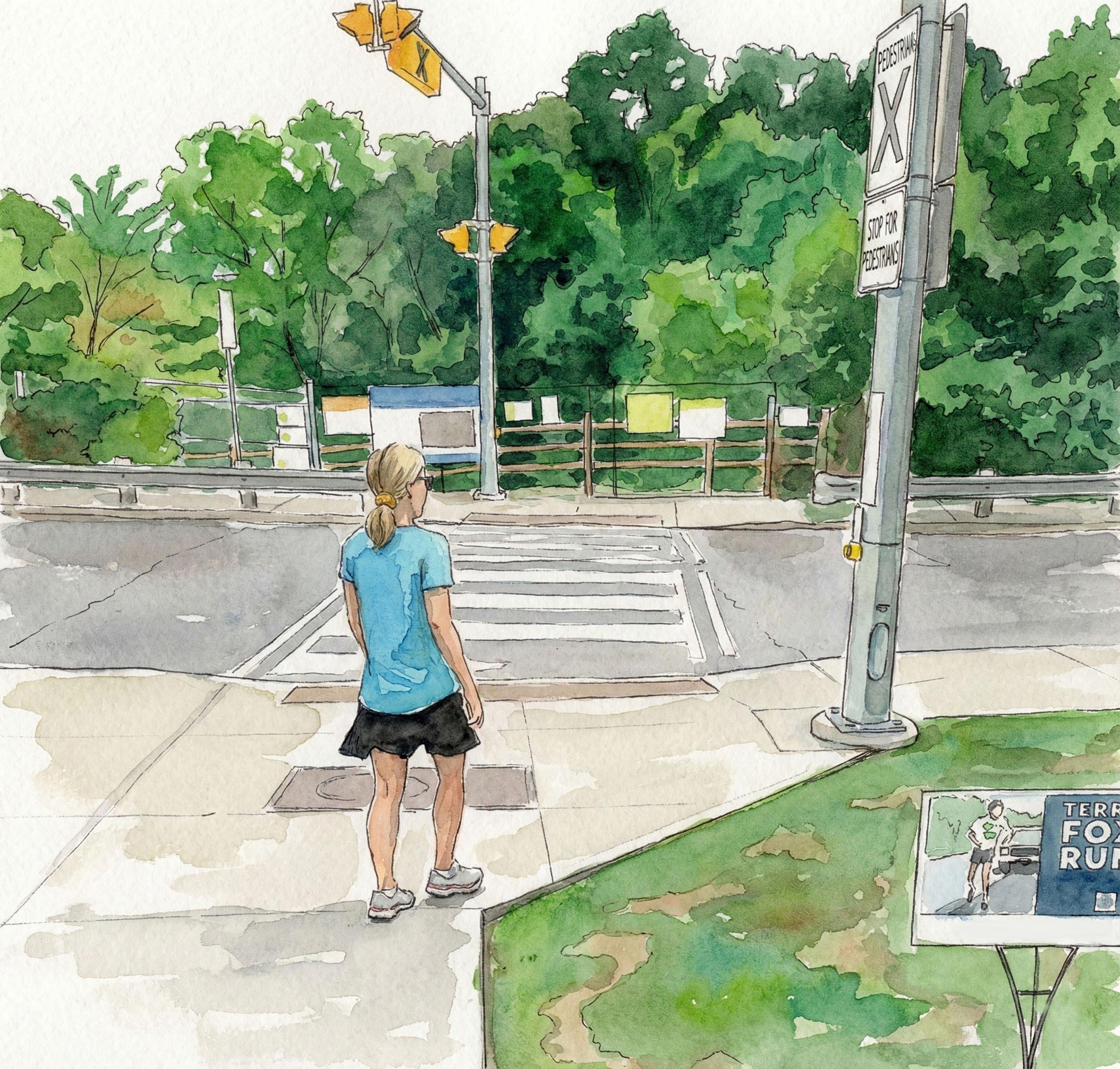
A pedestrian island that is missing crosswalks is inferior to a simple crosswalk. Pedestrians should never be asked to go out into traffic where the traffic isn't expected to stop for them. True, this spot on Bathurst is a bit close to Roselawn but I'm confident there's a way to make a crosswalk fit here. It's not rocket science.


This crossing is roughly the same distance from the nearest intersection as the crosswalk on Avenue Rd, but for some reason the city decided to go with one of those horrible dangerous pedestrian islands instead of a crosswalk.
Infrastructure like this is to be celebrated. What could have been a major trail barrier is a fun feature of the trail.
The trail goes through a narrow gate and under Mt. Pleasant Rd.
A simple crosswalk is all we ask for, and here we get it. In this picture the trail going down into Mud Creek is closed for improvements. It is now open again.
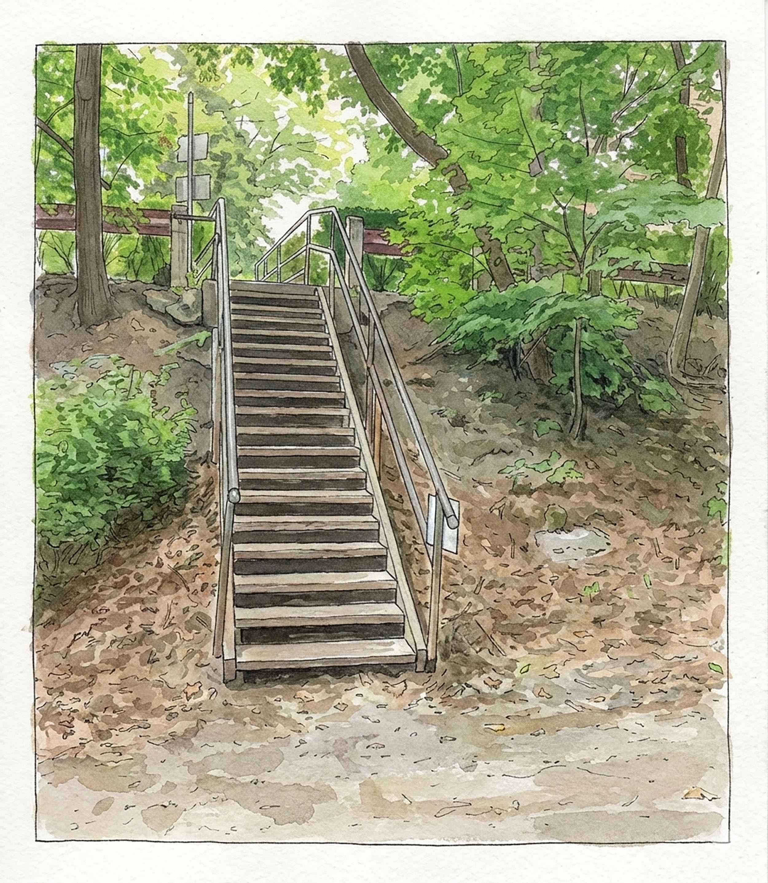
At the time of writing part of the trail was closed near this spot, requiring the use of stairs. The trail is now open here.
At it's peak The Don Valley Brickworks was producing around 25 million bricks per year. The factory operated from the mid 1800s until the 1980s. Restoration began in the 90s-- this included turning the former quarry, which had become a city dump, into a park.. The site is operated by Evergreen now, a Canadian non-profit organization and the Brickworks have become a tourist friendly cultural centre with an eatery and farmers market and souvenirs etc. It's also a great place to cycle to, located conveniently near the junction of the Beltline and the Lower Don trail. It draws many thousands of visitors every year.
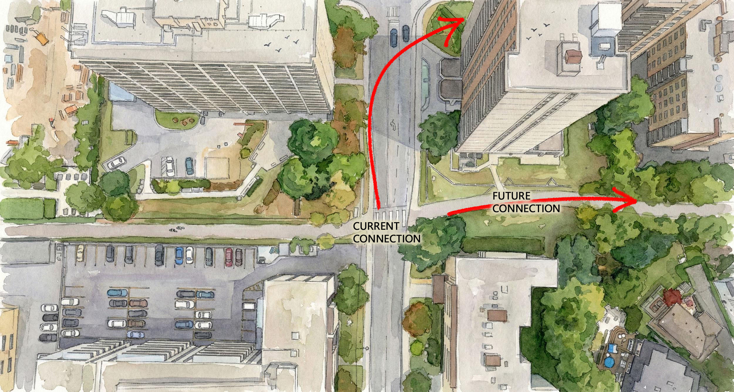
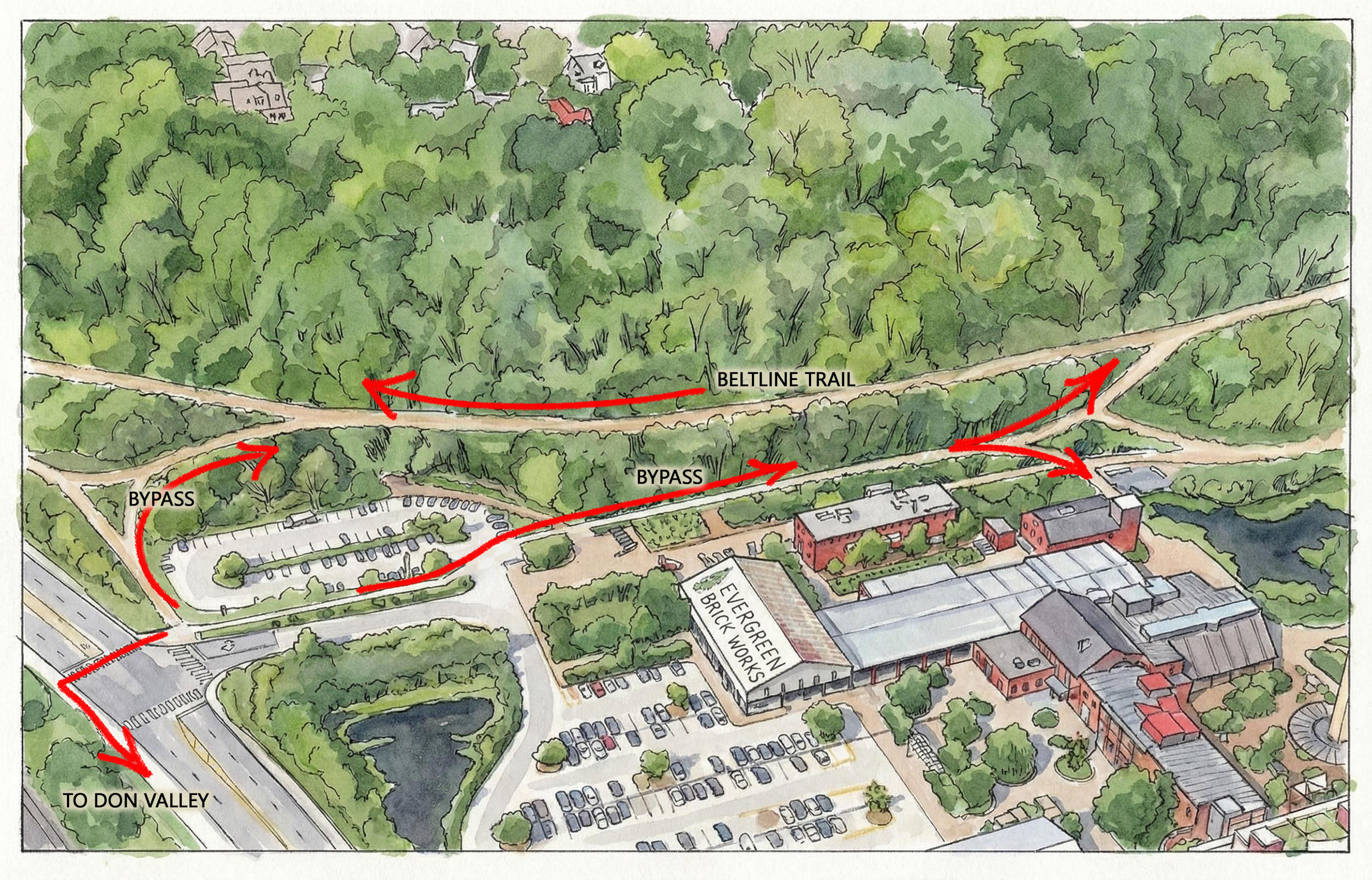
Entrance to the Brickworks from The Beltline. Where is the signage?
Entrance to the Brickworks from Bayview Ave. Facing North.
Bikes are meant to cut through the parking lot. Facing West.
As in many places on the trails, this spot could really use some signage. My first time through here I was sure that I'd taken a wrong turn somewhere. On a far flung section of trail this would be understandable, but this spot is close to the downtown and near the Brickworks, which draws many thousands of visitors yearly. To encourage trail use and make people feel more comfortable using the trails, the city really needs to prioritize better trail connections and improve wayfinding. As the trail turns West and heads up Yellow Creek it turns into Park Drive Reservation Trail, eventually petering out near Mt. Pleasant Cemetery.
Facing South
Looking East at Bayview Ave.
The Brickworks is a fun spot, but it could be better for cycling. Given its location (and Evergreen's interest in environmentalism) the Brickworks should be a hub for cyclists. The main issue as it is now is that connections to other parts of the trail network are poor. This is the same problem that plagues Toronto's multi-use trails throughout the GTA. The Brickworks though, is special, situated as it is at the junction of the Beltline, Yellow Creek, on the Bayview bike lane, and at an important spot on the Lower Don, a short ride from Taylor Creek, and the new East Don trails. An investment in making this into an important trail node seems like a no-brainer. It would be wonderful to see mobs of cyclists meeting here, drinking coffee and eating croissants, getting ready to head out on the trails.
This is a problem that we see in many places on the trail network. For the safety and convenience of trail users a little extra effort should be made to seperate cars and pedestrians and, where possible, walkers from cyclists. The entrance to the Brickworks doesn't currently do this, awkwardly routing bikes through a busy parking lot, and on through a busy pedestrian walkway. It's bad planning. Luckily it wouldn't be a difficult fix.
Trail as it is.
Trails as they could be.
Trail as it is.
Trail as it could be.
Bike lane on Bayview.
It's not a half mile long, but it is impressive. In 2007 the bridge was decomissioned and is now disconnected from the main line. The 'Lower Don Master Plan' proposed that an "art train" could use this section. Another idea is an elevated park. I'm not the first to notice that this bridge would make an excellent rail path to connect the Beltline to the Don Valley. This would by no means be the first time rail bridges have been converted into trails- The Kettle Valley Rail Trail in BC is an exhilarating ride, for example. Half Mile Bridge would be a wonderful compliment to the Brickworks and would perfectly connect these two important trails. As it stands now the connection is via a seperated, but unpleasant 1km or so ride up Bayview to Pottery Rd and the Don Valley Trail. It's enough to deter the casual trail user. A pedestrian-friendly rail bridge, on the other hand, would be an attraction.
Bike lane on Bayview Ave. under Half Mile Bridge
I've ridden Kettle Valley Rail Trail a few times. Good fun!
Bridge as it is now.
Bridge as it could be.
Bridge as it is now.
Bridge as it could be.
A major issue with the bottom of the Beltline trail, and the recreational trails in the GTA generally, is that the connections between them tend to be quite poor. It should be obvious that a netword is greater than the sum of it's parts and connecting the trails should really be a priority. The 'Lower Don Master Plan' from 2013 approached this issue in an interesting and ambitious way, daring to imagine a connection between the Beltline and the Humber via two bridges- one over Bayview Ave and a second over the Don River. I salute the ambition of this proposal.
From the 'Lower Don Master Plan, 2013
Trails as they are now.
Trails as they could be.


